What is a benchmark in geodesy. Ground and wall benchmarks
A geodetic mark is a ground structure at a geodetic point, used to place a sighting device (sighting cylinder) and install a geodetic device (instrument). Sometimes it has a site for a specialist to work, and also denotes a geodetic point on the ground. The survey mark (surface structure) and the center of the survey point (underground structure) together constitute the survey point.
A geodetic mark is constructed only at points of a trigonometric (planned) geodetic network (trigonometric point). Due to the differences in the technologies of definitions, at the points of the leveling (high-altitude) and gravimetric networks, the sign is not constructed or used.
Near the center of the point, at a certain distance, an identification mark is installed - a metal or reinforced concrete pillar with a security plate with the inscription: "Geodetic point, protected by the state." To ensure long-term preservation and consolidation on the ground, the point has an external design, determined by the "Instruction on the construction of a state geodetic network", "Guidelines for the construction of geodetic signs" and other departmental documents. Depending on the type of terrain, it can be: a shaft of stones, wooden blockhouse, ditching, burial mound, etc.
A geodetic mark can be wood, stone, reinforced concrete or metal. In some cases, the sign can be constructed temporary (collapsible, or transportable).
The geodetic mark can be in the form of a simple signal, a complex signal, a pyramid, a tour or a tripod, depending on the height to which the target or device needs to be raised, and based on local conditions. In lowland areas, signals and pyramids are most common, in mountainous areas - tripods and tours.
A reference (from the French repère - mark, sign, starting point) in geodesy is a sign that fixes a certain point on the earth's surface with a known absolute height. This height is determined by leveling with the original level surface. A metal disc with a diameter of 5 centimeters (brand) with a number and an indication of the department is fixed on the benchmarks. IN Russian Federation it is customary to calculate the heights of benchmarks relative to the zero mark of the Kronstadt footstock.
Fundamental benchmarks are reinforced concrete pylons. Such benchmarks are laid in the ground at a distance of 50 - 80 kilometers from each other on all leveling lines of the 1st class, the most important lines of the 2nd class and next to the main sea water meters. Another type of benchmarks is privates: they are laid after 5 - 7 kilometers on leveling lines of any class. Ordinary benchmarks, in turn, can be ground, which are installed in the ground, wall, which are laid in the walls of capital structures, and rock, laid in rocky ground. Finally, there are also secular benchmarks, which are laid at the intersection points of the 1st class leveling lines.
Fundamental and ground reference points form a state leveling network on the territory of the country and are used in studying the difference in sea levels, various prospecting works and as reference points for determining the heights of intermediate points of the earth's surface during topographic surveys.
In Russia in the Far East, the Baltic height system is used. At the end of the 1980s, the mark of the Kronstadt footstock was transferred to the coast of the Far Eastern seas, the expected error was approximately 1 meter.
Leveling mark - a point of the leveling network, which serves to fix a point, the height of which above sea level is determined by leveling. The mark is a cast metal disc with a diameter of 8 to 10 centimeters, embedded in the wall of a permanent (usually stone) building or bridge. In the center of the disc there is a hole with a diameter of about 2 mm, which determines the position of the mark. On the stamp, its number is cast, as well as the name of the organization that carried out the leveling work.
Unlike the benchmark, the mark can be deformation.
In the Russian Federation, the height of the leveling mark (holes in its center) is determined relative to the zero of the Kronstadt tide rod, and is given in the corresponding catalogs.
Deformation mark - a mark attached to a part of the structure of a structure (foundation, column, wall), in order to measure the settlement, roll or shift of the foundation.
The section is very easy to use. In the proposed field, just enter the desired word, and we will give you a list of its meanings. I would like to note that our site provides data from various sources - encyclopedic, explanatory, word-formation dictionaries. Also here you can get acquainted with examples of the use of the word you entered.
The meaning of the word rapper
rapper in the crossword dictionary
benchmark
Explanatory dictionary of the Russian language. D.N. Ushakov
benchmark
benchmark, m. (fr.repire) (geodetic). A firmly reinforced staffing platform with a well-defined height above sea level, serving as a starting point or reference point for leveling.
New explanatory and derivational dictionary of the Russian language, T. F. Efremova.
benchmark
m. A sign fixed on the ground, indicating a certain absolute height of a given point (in geology).
m. A set of two (on a plane) or three (in space) vectors with a common origin, not lying on one straight line and taken in a certain order (in mathematics).
m. Auxiliary point, at which the gun is zeroed for the subsequent transfer of fire to the target (in artillery).
Encyclopedic Dictionary, 1998
benchmark
in geodesy, a sign of a point with a known absolute height, a metal disc with a protrusion (or with a hole - a mark), fixed in the walls of permanent structures, or a concrete monolith embedded in the ground.
benchmark
REFER (French repere) in space (on a plane) a set of three (two) vectors with a common origin, not lying in the same plane (on one straight line) and taken in a certain order.
Rapper
Rapper
- Rapper
- Rapper
- Rapper
- Reference point
- Rapper
Benchmark (geodesy)
Rapper(from - mark, sign, origin) in geodesy - a sign that fixes a certain point on the earth's surface with a known absolute height. This height is determined by leveling with the original level surface. A metal disc with a diameter of 5 centimeters with a number and an indication of the department is fixed on the benchmarks. In the Russian Federation, it is customary to calculate the heights of benchmarks relative to the zero mark of the Kronstadt tidestock.
Benchmark (geometry)
Rapper (sign, origin) is the set of a point of the manifold and the basis of the tangent space at this point.
Benchmark (affine geometry)
Rapper(from - sign, origin) or point basis affine space - a generalization of the concept of a basis for affine spaces.
Benchmark of affine space A associated with vector space V dimensions n, is a collection of point O ∈ A(origin) and an ordered set of n linearly independent vectors e, …, e ∈ V(that is, the basis in n-dimensional vector space V). This is equivalent to specifying an ordered set of n+ 1 affinely independent points O, P, …, P ∈ A... In this case, obviously, the vectors are $ e_1 = \ vec (OP_1), \ ldots, e_n = \ vec (OP_n) $.
Coordinates points X ∈ A relative frame ( O; e, …, e) are the coordinates of the vector $ \ vec (OX) $ with respect to the basis e, …, e... In the same way as when choosing a basis in a vector space, any vector of this space is set by its coordinates, any point in the affine space is set by its coordinates relative to the selected frame. If relative to the reference ( O; e, …, e) dot X ∈ A has coordinates ( x, …, x), and the point Y ∈ A- coordinates ( y, …, y), then the vector $ \ vec (XY) $ has with respect to the basis e, …, e coordinates ( y − x, …, y − x).
Benchmark ( O; e, …, e) is called orthogonal (orthonormal) if the corresponding basis e, …, e is orthogonal.
Benchmark (artillery)
Rapper- a real or conditional point on the ground used for zeroing in artillery pieces. These benchmarks are used to transfer fire to real targets without prior zeroing. There are two types of benchmarks: real and fictitious.
Examples of the use of the word “benchmark” in literature.
At the top of Iremel, neither benchmark, no fragments of a trigger point, just various rubbish brought up here by tourists.
And the hyperlight exhaust is an explosion with a capacity of tens of megatons, which carries a potential danger for lighthouses, highway benchmarks and other ships.
benchmark permafrost identification ground
Ground benchmarks of types 160 op. sign and 162 op. the sign (Fig. 5, 6) in the area of seasonal freezing of soils, as a rule, is laid in drilled wells with a diameter of 50 cm. in advance. It is allowed to use square slabs 50x50 cm in size.
A mark must be cemented into the upper face of the pylon (Fig. 7). In the middle of the concrete slab, a recess with a size of 20x20x15 cm is made, into which a reinforced concrete pylon is installed. The pylon can be replaced with an asbestos-cement pipe with an outer diameter of at least 16 cm, filled with concrete with reinforcement. A mark is inserted into the upper edge of the pipe.
When using an asbestos-cement pipe to increase the connection of its base with the anchor at a distance of 7-10 cm from the base of the pipe, insert two mutually perpendicular rods 1.0-1.2 cm thick and 25 cm long.
When installing the pipe in the anchor hole, the ends of the rods are placed in the corners of the recess. In the southern zone of the area of seasonal soil freezing, concrete slabs (anchors) with a height of 20 cm are used, in the northern zone - 35 cm.The border between these zones runs along the Valuyki-Rossosh-Kamyshin-Pallasovka line.
It is allowed to lay benchmarks in wells with a diameter of 35 cm, but in this case, the height of the concrete anchor in the southern zone should be 50 cm, in the northern one - 80 cm.
The upper edge of the concrete slab (anchor) of the leveling reference of I, II, III and IV classes should be 30 cm below the depth of the greatest freezing of the soil, regardless of the diameter of the well. For all benchmarks, the mark should be 50 cm below the surface of the earth. It is allowed to manufacture an anchor by pouring liquid concrete into the well.
The depth of the borehole is the same as when laying the benchmarks made in advance. In wells with a diameter of 50 cm, concrete is poured respectively 20 or 30 cm, and in wells with a diameter of 35 cm - 30 or 70 cm. concrete mortar insert a pylon or asbestos-cement pipe. The length of the pylon or pipe should be such that the mark falls at a distance of 50 cm from the surface of the earth.
It is possible to fill the wells with soil, without waiting for the concrete anchors to set, provided that a layer of sand (loosened soil) with a thickness of at least 10 cm is backfilled on the liquid concrete.
It is allowed to replace reinforced concrete pylons with metal pipes 6 cm in diameter with a wall thickness of at least 0.3 cm or a piece of rail (Fig. 6).
In this case concrete slab(anchor) and a pipe (rail) are fastened together at the place where the benchmark is made. The metal pipe should have four pins protruding 10 cm from it.
When laying benchmarks, a layer of cement mortar with a thickness of at least 3 cm is poured under the base of the slab at the bottom of the well or foundation pit. It is forbidden to lay benchmarks into the foundation pit (well) with soil loosened or poured onto the bottom.
Reinforced concrete benchmarks, laid in aggressive soils, are made of dense concrete.
In areas of moving sand, benchmarks of type 15 are used (Fig. 8), laid by screwing into the ground to a depth of at least 400 cm. The benchmark consists of a galvanized pipe, the upper end of which with the mark is placed 80 cm above the ground surface. A protective plate is attached to the pipe. Ditching in this case is prohibited.
In swampy areas, the leveling lines are fixed with ground tubular benchmarks, using pipes with a diameter of 6 cm with a wall thickness of at least 0.3 cm.A screw anchor with a diameter of at least 15 cm or a drill spiral tip (auger, coil) with a diameter of at least 10 are welded to the lower end of the pipe. cm and a length of at least 50 cm.
The pipe is screwed to such a depth that the screw anchor enters the underlying water-saturated layer of dense rock by at least 150 cm, but in all cases the depth of the benchmark should not be less than the depth of the maximum freezing of the soil plus 100 cm. wetlands, you can lay benchmarks, consisting of several screwed together drill rods or pipes with a diameter of 4-6 cm with a wall thickness of at least 0.3 cm.
A metal cone is welded to the lower end of such a benchmark. The rods (pipe) are driven into the ground to such a depth that the cone enters the underlying water-saturated layer of the rock by at least 300 cm.The upper end of the rod (pipe), to which the brand is welded, is placed 30 cm below the surface of the earth.
The moment of entry of the screw anchor (spiral tip or cone) into the dense underlying water-saturated layer of the rock is determined by a sharp slowdown in the rate of immersion of the benchmark in the ground. Around the benchmark, a wooden blockhouse with a size of 200x200 cm and a height of 50 cm is erected, filled with peat or mineral soil. A metal identification post 100 cm long with a protective plate is installed in the frame.
In the northern and middle zones of the area of permafrost soils, tubular metal benchmarks of type 150 are laid in drilled or thawed wells (Fig. 9). Metal pipes are used as a benchmark. The pipe diameter is 6 cm, the pipe wall thickness is at least 0.3 cm.
A brand is welded to the upper end of the pipe, and a multi-disc anchor is welded to the lower end, consisting of a metal disc and eight half-discs 0.5-0.6 cm thick and 15 cm in diameter.

For better screwing (pressing) of the pipe into the ground, the metal disk has blades.
The pipe is not filled with concrete.
On the outer surface of the pipe, an anti-corrosion and anti-heap coating is applied, and on the inner surface, only anti-corrosion.
With a soil thaw depth of up to 125 cm, the base of the benchmark is placed 200 cm below the thaw boundary.
If the thawing depth is 125 cm or more, then the base of the benchmark should be 300 cm below the thaw line.
In the presence of stony inclusions in the soil that impede drilling and thawing of wells, tubular benchmarks of type 165 op. the sign (Fig. 10) is laid in the pits.
Instead of a multi-disc, a concrete anchor is made with a diameter of 48 cm and a height of 20 cm.
The base of the concrete anchor is placed 100 cm below the boundary of the greatest thawing of the soil.
For all benchmarks in the area of permafrost soils, the upper end of the pipe with a welded mark is placed at ground level.

In the southern zone of the region of permafrost, the border runs along the line Vorkuta-Novy Port-Khantayka-Suntar-Olekminsk-Aldan-Ayan, only tubular benchmarks with concrete anchors are laid. If, during the work, permafrost soils are not found, then the depth of the benchmark is increased by 50 cm and the upper end of the pipe with the mark is placed (due to this increase) 50 cm below the surface of the earth.
It is prohibited to use metal anchors instead of concrete anchors in the southern zone of the permafrost region.
In the rock, located on the surface or lying at a depth of 70 cm, a ground benchmark of type 9 op is laid. mark (Fig. 11), which consists of a mark on cement mortar. At 100 cm from the benchmark, a reinforced concrete or tubular identification post with a protective plate is installed. The identification post is reinforced in the rock cement mortar, apply an anti-corrosion coating and paint. Around the identification pillar and above the benchmark, if it is on the earth's surface, a round is laid out of stones 50 cm high and up to 1 m in diameter.If the rock lies at a certain depth, then the mark is covered with rock, and then the round is laid out.
If the rock lies at a depth of more than 70 cm, then a benchmark of type 176 op is used. sign (fig. 11). A reinforced concrete pylon with a slab (anchor) is installed on the rock. The pylon is cast in such a height that its upper edge is 50 cm below the surface of the earth. In the area of permafrost soils, it is allowed to lay a tubular benchmark with a concrete anchor instead of a reinforced concrete rock benchmark.

If there is a steep rock near the benchmark at a distance of up to 50 m, then on it oil paint a triangle with sides of 100 cm is drawn in bright colors, inside which the reference number and the initial letters of the organization that performed the work are indicated.

Wall benchmarks of type 143 are laid in the walls of artificial structures, buildings and the vertical surface of the rock (Fig. 12, 13).
When making a wall benchmark and marks (Fig. 7, 12, 13), the initial letters of the name of the organization that performed the leveling and the benchmark number are cast on the signs.
The wall bench, shown in Fig. 12, is laid on the leveling lines of I and II classes, and the one shown in Fig. 13 - on the leveling lines of III and IV classes.
External design of benchmarks. The outer design of the century-old benchmark consists of a reinforced concrete well with a protective cover and a lock; a mound made of stones; an indicative monolith and a fence of four sections of rails (reinforced concrete pillars with a section of 20x20 cm) with anchors laid to a depth of 140 cm and protruding 110 cm above the ground (Fig. 14).
It is allowed to use other external design, which ensures the reliable preservation of the age-old benchmark.

The design of the fundamental benchmark in the area of seasonal soil freezing consists of a rectangular ditch (Fig. 15) and a reinforced concrete identification pillar (Fig. 16) with a protective plate (Fig. 17) with a thickness of at least 0.8 mm. The plate should face towards the benchmark. A mound with a height of 30 cm and a diameter of 150 cm is made above the benchmark. The part of the identification pillar protruding above the ground is painted with oil paint of bright colors. The cross-section of the ditch along the lower base is 20 cm, along the upper - 120 cm, depth - 70 cm. The name of the organization and the reference number (for example, Roskartografia, 1274) are signed with black paint on the identification post. A mound of stones 150x150 cm, 70 cm high, is laid out above the rocky fundamental benchmark.
The base of the identification pillar is cemented with rock or rock.
In the area of permafrost soils, the external design of the fundamental benchmarks is the same as for ground benchmarks, but in forested areas, a tubular metal identification pole is placed (Fig. 9 and 10), and within a radius of 100-150 m from the benchmark on trees at a height of 150-250 cm make ten marks with bright paint, which should look towards the benchmark. The outer design of the ground benchmark (Fig. 18) is a ditch and an identification post in the form of a reinforced concrete pylon with a slab (anchor), installed 80 cm from the benchmark. In forested areas, it is allowed to install wooden identification poles.
The size of the lower base of the ditch is 20 cm, the upper one is 120 cm, the depth is 50 cm, the length is 1280 cm. A mound with a height of 30 cm with a diameter of 100 cm is poured over the benchmark. The length of the pylon, which has two sides in the upper part, is 140 cm section 16x16 cm. The diameter of the plate is 48 cm, the thickness is 15 cm (Fig. 16).

The connection of the pylon to the slab is the same as for the benchmark. The base of the slab is placed 80 cm below the surface of the earth. When using an anchor with a diameter of 34 cm, its height is increased to 25 cm, and the depth of the bookmark is up to 90 cm. A protective plate is securely attached to the identification post (when casting the pylon) (Fig. 17). The inscription on the plate is cast, stamped or applied by punching.
When installing the identification post, the protective plate must face the benchmark.
The part of the identification post protruding above the ground is painted with oil paint of bright colors (red, orange, yellow). The number of the benchmark and the name of the organization that laid it down are indicated in black paint on the pillar. The identification post can be tubular. A metal plate is welded to the top of the pipe, to which a protective plate is bolted to it. The pipe on top of the anti-corrosion coating is painted within the protruding part with brightly colored oil paint.
On the reverse side of the plate, the reference number and the initial letters of the organization that laid it are inscribed in black paint. A plug is welded to the upper end of the pipe.
The lower end of the pipe should have a concrete (metal) anchor with a diameter of 48 cm and a thickness of 15 (0.5) cm, buried in the ground by 100 cm.When using an anchor with a diameter of 34 cm, its height is increased to 25 cm, and the depth of the bookmark is increased to 90 cm. The top of the tubular identification post must be 100 cm above the ground.
In forested areas of the permafrost region, as well as in wetlands of the area of seasonal freezing of soils, a frame of logs 200x200 cm in size, 50 cm high is built above the ground benchmark (Fig. 19).

The blockhouse is filled with soil and moss, which are taken no closer than 15 m from the benchmark. In the frame above the benchmark, a wooden post 70 cm long is installed, and next to it is a metal identification post, within a radius of 100-150 m from the benchmark, ten marks are made with bright paint on trees at a height of 150-250 cm.
In the tundra, above the benchmark, a mound of earth and moss is erected with dimensions of 200x200 cm, a height of 50 cm. The mound is covered with a layer of turf. A wooden post 70 cm long is installed above the benchmark, and an identification post next to it. Land, moss and turf are taken no closer than 15 m from the benchmark.
In the permafrost area, depending on how the benchmark is laid, by drilling (thawing) or into a pit, an identification metal post is installed at a distance of 100 or 70 cm from the benchmark (Fig. 9, 10). The lower end of the pipe must have an anchor, which is buried in permafrost soil at least 50 cm. The upper part of the identification mark is placed 100 cm above the ground and painted with brightly colored oil paint. Various mechanisms can be used for digging pits, drilling wells, driving piles and screwing in pipes (Appendix 8).
- · A report with an explanatory note; benchmark logs;
- · A list of embedded benchmarks and a diagram of their location (on a map of the largest scale);
- · Acts of handing over benchmarks under the supervision of safety;
- · Photographs of buildings and rocks, in which the wall benchmarks are laid;
- · Maps of scale 1: 25000 and larger, aerial photographs showing the locations of the established and surveyed benchmarks, outlines. The scale of the outline is chosen so that the nearest landmarks specified in the description of the location of the benchmark fit on it. Outlines are drawn by eye, according to maps, aerial photographs in conventional conventional topographic signs, horizontals are drawn on them conventionally, only to show the nature of the relief.
IN separate document the schemes of determination and materials of observations on the instrumental determination of the coordinates of fundamental, secular and ordinary benchmarks and a list of the coordinates of the benchmarks along the leveling lines are given.
Coordinates of secular and fundamental benchmarks, determined by instrumental methods, are given with an error of no more than 1.0 m, ordinary benchmarks and marks with an error of no more than 10 m.
Sometimes scientific or other specific concepts are used in areas not related to the original one. This happened with the geodetic term "reference point". By definition, a geodetic benchmark is a mark or sign fixed at a specific point on the earth's surface. The coordinates and height of this place are calculated by leveling with respect to a known and generally accepted value.
Level systems of heights
In Russia and some countries the former USSR The Kronstadt tide rod is considered to be the zero mark for reading the surface level. All geodetic marks indicated on the maps of these countries are calculated according to the Baltic system of heights adopted in 1977. In the regions of the Far East, calculations are carried out according to the Okhotsk system of heights. Its error relative to BSV is less than one meter.
A footstock is a rail with divisions for determining the water level in a river or other body of water. Sometimes permanently installed footstocks, as control points and reference points in geodesy, are used by scientists to observe changes in the water level in the seas, for the movements of the layers of the earth's surface along the vertical.
About the Kronstadt foot gauge and the determination of the sea level
Initially, the change in the height of the Gulf of Finland was marked by horizontal notches on the walls of canals and basins, on the surfaces of locks. When in 1777 a special service was organized in Kronstadt, observations of the water were carried out according to the marks of the footstock from the bottom
Long-term (since 1731) and regular notes, observations of fluctuations in water levels in the Gulf of Finland were processed by the hydrographer MF Reinecke in 1840. According to the average readings he calculated, a horizontal line was carved on a stone support of one of the bridges across the Obvodny Canal. A few decades later, a metal plate was fixed at this level with a horizontal mark that practically coincided with the zero reading of the tidestock.
Transfer of sea level to land

This level indicator was transferred to the mainland by leveling along the line of the St. Petersburg - Oranienbaum railway and “tied” with a bolt mark to one of the buildings at the Baltic station. This bolt has been the main benchmark for all leveling measurements in the country since 1892.
In 1946 on the territory Soviet Union a unified system of coordinates and heights was introduced. The level was taken as the initial one. Baltic Sea with a mark corresponding to zero on the Kronstadt footstock. This is the reference point of the state leveling system. From the mark, heights and depths are calculated for all domestic maps and directions, orbits for spacecraft flights are determined.
Varieties of benchmarks in geodesy
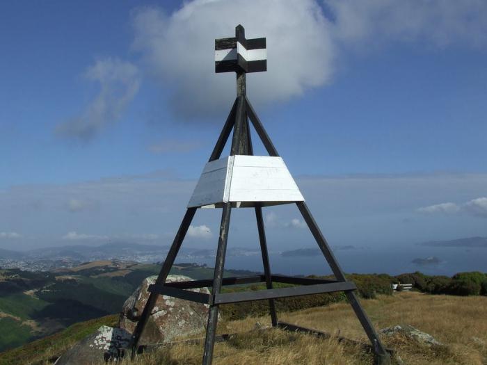
On the ground, the reference point is designated by a pyramid-shaped structure made of stones, boards or metal tubes. Depending on the purpose, there are several types of benchmarks:
- Centuries are distributed in accordance with a special scheme throughout the country. They are installed according to the instructions in the specified geographic points. They are used mainly for scientific purposes.
- Fundamental ones are equipped along all leveling lines of the first class (between the secular ones) and along the most important lines of the second class. The distance between the points is from 50 to 80 km. They are laid exclusively in the ground in the form of reinforced concrete pillars and pylons. Since the fundamental benchmark can be used only in certain cases, an ordinary benchmark satellite with accurate transferred data is installed not far from it. It is used as a support for leveling grades 3 and 4.
- Ordinary benchmarks are wall, rock and ground. Anchored at a distance of 3.5 to 7 km from one another, these signs can be laid along all leveling lines.
The system of interconnected fundamental and ordinary reference points forms the GGS - the state geodetic network.
Cartographic designation of geodetic marks
On maps, the reference point is marked with special icons. They are distinguished as follows:
- for astronomical points;
- for points of the SHS;
- for central points fixed on the territory;
- for points of survey networks;
- for points of the state leveling geodetic network.
All these points are marked on the real surface of the Earth by metal pyramids or ordinary benchmarks. Geodetic centers, indicating the location of the point, are plotted on maps by coordinates, that is, as accurately as possible, with indications of elevation marks.
What is a datum point? Uplands, mounds, hills or detached buildings with spiers, towers or bell towers included in the general geodetic network are designated by conventionally adopted combined symbols. The points of the GHS in the maps with a large scale are indicated absolutely everything. Astronomical points, which are landmarks, are indicated only in cases when they are starting points in a given area.
Triangulation (reference) points, their installation

The installation of permanent signs is carried out by the State Geodetic Leveling Network. The ground parts of the benchmarks are mutually visible to each other at a certain distance. The design and height of the signs depend on the purpose, local conditions, soil and distances from one point to another.
Geodetic points can be made in the form of metal or wooden pyramids, stone or reinforced concrete pillars. The height of each structure depends on the location of the anchor. Any benchmark serves as a tripod or support for measuring tool and an observer.
The underground part of such a structure is made in the form of a foundation monolith poured with concrete. The point itself, which is the center of the point, is embedded with a metal cast mark. The inscription on the latter indicates the number and type of this item. The name of the organization that performed the work and the year of installation are cast together with a tag (usually cast iron).
Construction and reference marks

Disc-shaped benchmarks made by cast iron are installed in the walls of industrial buildings, sluices, in abutments and this is done to monitor the static state of large structures. On disk marks, in addition to inscriptions, there are protrusions intended for installation.The purpose of geodetic marks can be divided into the following categories:
- reference, or control, which are the basis for determining the position of the established marks, taking into account the safety and stability over time;
- auxiliary - these are intermediate signs for transferring coordinates and values between deformation and reference marks;
- deformation marks, which are fixed directly on the walls of the observed structures or buildings (with spatial changes in the position of the object, these marks move with it).
Reference points in construction are a guarantee of timely detection of the mobility or instability of a large object, such as a hydroelectric dam or a high-rise building.
Who needs it all
Thanks to the interconnected system of designated points, a state geodetic network is formed. Special catalogs contain lists with specified coordinates of all such points. This information is used by topographers to study the surface of the planet, in engineering and geodetic surveys, for various needs of the country's economy.

Lists indicating the values of coordinates are brought to the officer corps of the army along with topographic maps. Artillerymen are also well aware that a reference point is a mark indicating a known height, a kind of support for zeroing in on the ground.
The reference points on the Celsius temperature scale are considered to be the values of boiling and freezing of water at sea level.
In business, this concept is used to describe a certain state of affairs when certain actions can lead to either complete failure or success.
Health, entrepreneurship
Since a reference point is a kind of reference indicator, a "clue", this concept can be applied in many spheres of human activity.
Investigating the causes of frequent stress in people constantly living in metropolitan areas, scientists have found that the fault is an unnatural visual environment. The spread of right angles and lines, buildings of uniform color, a large number of static objects negatively affects emotional condition person. The psychophysiological direction in science, called visual ecology, claims that the absence distinctive features architectural decorative elements overloads

The eye must select, fix some point, detail, element in visual space so that the brain perceives environment as comfortable, close to natural and harmonious. Only then does a person have a sense of aesthetic and emotional satisfaction.
Benchmarks in business are a kind of airbag. They can be used to increase the competitiveness of an enterprise. If you take as a basis some marketing techniques or the state of affairs in the current period, you can identify complex measures that need to be taken to change the situation for the better.
We are accustomed to the fact that a modern city is penetrated by many different networks - communications, water supply, gas, transport and so on. Among them there is another network, not that completely invisible, but little-known to the uninitiated. Perhaps you have ever noticed metal signs hammered or cemented into the walls of buildings. They're called geodetic benchmarks and together they constitute the state leveling network (GNS).
One of best descriptions geodetic benchmarks can be found in the 1934 Technical Encyclopedia.
Once, a couple of years ago, I tried to clarify some questions for myself on my own, but it turned out that there are a dozen of materials on geodesy on the Internet, but common man it is not so easy to understand this mass of information, and especially in relation to our Chelyabinsk realities. And just recently the opportunity presented itself to ask questions to specialists. They were answered:
Sergei Reingoldovich Reizvikh- Director of LLC NPF "Nedra".
Sergey Vasilievich Vorobyov- Former leading architect of Chelyabinsk, responsible for the creation, maintenance and development of geodetic networks.
Vladimir Nikolaevich Ivanov- cadastral engineer.
Dmitry Yurievich Mylnikov- Head of the Design Automation Department of the PC GPI Chelyabinskgrazhdanproekt.
Evgeny Anatolievich Maslov- Head of the department for the protection of state secrets and mobilization training of the branch of the Federal State Budgetary Institution "FKP Rosreestr" in the Chelyabinsk region.

What are benchmarks and what are they for?
D. Mylnikov: Rappers and wall leveling marks are part of the leveling (high-altitude) network, which serves to measure the height relative to sea level when performing various engineering and construction works... On the territory of Russia, the sea height is measured relative to the zero of the Kronstadt tide stock and is called the "Baltic system of heights". All benchmarks are made in such a way that a leveling rod can be installed on them or suspended from a special hole, with the help of which height measurements are made.
S.R. Reizykh: At present, after leveling the state high-altitude network from Kaliningrad to Anadyr, the high-altitude marks are determined in the Baltic height system of 1977, which differs from the Baltic one by an average of 20 cm in the territory of the Chelyabinsk region.
D. Mylnikov: To determine the exact position on the ground, that is, coordinates, the points of the state geodetic network (GGS) are used. The difference between GGS points and high-altitude benchmarks is that they have a clearly defined center, the coordinates of which are determined. At each point, its number must be applied, which is entered into the catalog. All other parameters of the item are determined by the catalog. In addition, the year of establishment, the name of the organization and other parameters that are optional can be applied. At the same time, in practice, even the absence of a number on the benchmark is not critical, since all points are also marked on topographic maps and plans, as well as in the so-called "outlines" (schematic plans), according to which surveyors find them on the ground.
The points of the GGS are the so-called "geodetic towers", which you probably saw outside the city. At the same time, the tower itself is only needed so that it can be seen from afar, and the point itself is located under it in the form of a special sign filled in concrete base... At the same time, the most accurate points of the 1st class and the astronomical and geodetic network have another duplicate sign at the depth, which will be used to restore the point in case of damage. The coordinates of these points are calculated with a very high precision, for points of the astronomical-geodetic network - using special astronomical measurements relative to the position of the stars. The points of the GGS are usually also points of the leveling (high-altitude) network, since for them, in addition to coordinates, the height above sea level is also determined.

S.R. Reizykh: In turn, in urban conditions, the reference points of the leveling network are also very often used as GGS points - for such points, not only the height is determined, but also coordinates in one or another geodetic coordinate system associated with the Earth's surface.
D. Mylnikov: In addition, there are so-called points local geodetic networks, which are also called support-boundary networks(OMS). They are created in settlements and are used when defining the boundaries of land plots and outlining works during construction, that is, when determining the place where it is necessary to build a house or lay a road. Such points do not have geodetic towers. When building large objects or building large sites, temporary benchmarks and points are often created for the period of work, which allows you to speed up and simplify the whole process. Often these are temporary structures, for example, driven into the ground metal pipe or a rail, the top of which serves as a mark, so after construction is completed, they cease to exist.

E. Maslov: Reference-boundary networks are also installed by surveyors, but they are used for local purposes, for settlements somewhere in the region - in Sosnovka, Argayash, etc. After the completion of the work, the surveyors, according to the act, transfer the OMS to the municipality, and then the municipality is responsible for their safety. Such labels are taken into account for individual directories.
S.R. Reizykh: What else are benchmarks used for? To identify the influence of man-made processes during the construction of structures on quicksands, roads, bridges, metro lines, special observation stations are installed - in urban conditions they are also laid in the form of wall benchmarks.
The existing wall benchmarks are of colossal importance, since they were used to bind and break down the construction elements of the adjacent territory. If there are discrepancies in the position of the boundaries of buildings, structures, land plots, these wall marks are the basis for a forensic geodetic examination.
What are the rappers?
S.R. Reizykh: There are several varieties. Century benchmarks provide long-term preservation of the elevation mark, they are not found on the territory of the Chelyabinsk region. Fundamental benchmarks are located along the railway and are reinforced concrete pylons 30x30 cm, in which metal signs are laid. In the rest of the region, the high-rise network is represented by unpaved and wall benchmarks.
D. Mylnikov: Ground marks necessarily have a concrete base - "anchor", into which a metal, usually cast iron, mark with marking is poured. Wall benchmarks are installed in the foundations of the rear and structures, including in the supports of bridges.


V. Ivanov: You can read more about the types of benchmarks.
S.R. Reizykh: Rules for the design of benchmarks -.
What other information can be obtained by looking at a specific benchmark?
D. Mylnikov: Usually, its number and the name of the manufacturer are cast on the benchmark, sometimes the year. An engraved height value is sometimes found on ground benchmarks. All other parameters, except for the number, are optional and not always accurate, since all the exact parameters of the points of the leveling network are recorded in a special catalog.
The number on the benchmark is often not the ordinal number of the item, but the unique number of the piece of iron itself, which is assigned to it during manufacture at the factory (like the body number of a car). Likewise, the year that is cast rather than engraved is the year the mark was made, not the year it was installed. That is, everything that is cast was applied at the factory at the time of manufacture, and cannot have any connection with a specific place and time of installation of the sign. Everything that is engraved (cut out) is applied already at the time or after the installation of the sign and refers to the parameters of a specific sign in a specific place.
But even the presence of the number on the benchmark is not required. In the catalog of points of geodetic and leveling networks, in addition to the number and parameters, there is always an "outline", that is, the layout of the benchmark or point on the ground. In addition, the points are often marked on the duty topographic plan of the settlement. In this case, in practice, usually, first, using a topographic plan or an outline, they find out where the benchmark is approximately located next to the work site, and then they are looking for it on the ground. The probability that several benchmarks or points will be laid nearby is very low, therefore the absence of a number for its practical use is not critical.
E. Maslov: The address of the object is also indicated in the reference catalog. By the time of the laying, it is already known, since the benchmark is installed after the building is built. That is, construction begins with surveyors and ends with them.

Who is responsible for creating, recording and storing information about benchmarks?
D. Mylnikov: The catalog of points of state networks is kept in the state geodetic fund, for which in this moment the State Registration, Cadastre and Cartography Service is in charge.
E. Maslov: The catalog is labeled "For Official Use". Currently, all organizations performing cartographic and geodetic work are required to receive this data and use it in their work.

In what years did you start installing benchmarks and when and why did you stop doing it?
D. Mylnikov: Benchmarks began to be actively installed in the 30s, when industrialization and the construction of large industrial enterprises and residential buildings began. Although leveling and geodetic networks were created even before the revolution, for example, during the construction of the Trans-Siberian railway line, which passed through Chelyabinsk. At the same time, at different times, the marking and the amount of information on the benchmarks were different. To find out now what and where was indicated, you need to raise the archives, watch the reports on the progress of work on their installation.
New benchmarks and signs are still being installed, but mainly where new construction is underway. It makes no sense to install new benchmarks in the old quarters, since there are enough old ones, and the amount of work for which they are needed is less in the old built-up area. In principle, the main purpose of benchmarks and points of geodetic networks is precisely to fix the reference position for as long as possible. In practice, this means that as soon as this or that territory is mainly built up, the installation of new benchmarks stops there. And until some large-scale reconstruction begins, when the old buildings are demolished, in the foundations of which the benchmarks are laid, no one will install new ones.
However, recently, in connection with the development of technologies for performing work using GPS and GLONASS, the need for the installation of benchmarks and points of the geodetic network has sharply decreased. This does not mean that they are not needed at all, but now they can be installed much less frequently (with large distances from each other).
S.R. Reizykh: As far as I know, the last benchmarks were installed during the construction of the subway. These are ordinary metal signs, laid along Lenin Avenue before the Aeroflot agency. As a recent example, we can also cite our benchmarks on the building of the regional legislative assembly, which were laid around 2002.


What measures are (were taken) to the safety of benchmarks, are they periodically inspected, restored?
D. Mylnikov: State geodetic and leveling networks are protected by the state, administrative punishment is provided for damage to points of the GGS and GTS. As for benchmarks, most of them belong to local networks, for which the municipality is responsible, which must monitor their safety. But due to the fact that lately there have been constant changes in the state authorities responsible for geodesy and cartography, which from a separate service have now become part of the state registration, cadastre and cartography service, in reality no one really does this. That is, the problem of the safety of benchmarks and geodetic points exists.
As such, a special inspection of the items is not currently being carried out. Usually it is replaced by constant use in the process of performing geodetic works. In the event that a specialist finds any problems with a point, he usually reports this to the accounting authority (if only because he has to take the parameters of another, neighboring point).
The restoration of damaged or lost points of local networks is usually not involved, since it is easier and faster to lay a new point and determine its parameters. If there is a suspicion that the position of the benchmark or point is violated, then you still have to make new measurements at neighboring points. And if the mark itself is lost, then the new mark may have different sizes and a different registration number.
V.S. Vorobiev: During the Soviet era, checkpoints were inspected, and special money was even allocated for this. In 1992-1994, as far as I know, on the territory of Chelyabinsk, the cycles of observations of the settlement of buildings and structures in the zones of metro construction were carried out annually by a small but quite qualified enterprise MUP "Chelyabgeocenter". After the cessation of its existence, the banner was picked up by "Uralmarkscheideria", which is still observing, for which honor and praise it is - it is very difficult in our mercantile time to obtain funding for such works, which do not promise momentary benefits.
As for the responsibility for safety, I personally do not know of a single case that someone was really punished for the destruction of the state geological mark. The main trouble is facing works on the facades.

E. Maslov: In the city, the destruction of points is not so noticeable, because it is mainly iron and concrete, and even wooden towers still remain in the region. Some of them were knocked down, destroyed. They are not being followed - this is also due to mismanagement, but also because there is no great need for them - GPS is being used more and more often.
Why is the concentration of benchmarks in the city center higher than in the outskirts?
D. Mylnikov: Where the work was more active, there were more benchmarks and points and were installed. At the same time, the center is usually built up more densely, the line of sight between the points required for measurements is less, therefore, to simplify and speed up the work, they tried to establish more benchmarks and points. In new areas, the building density is lower, the line of sight is greater, so benchmarks can be installed at a greater distance from each other. In addition, with the advent of new equipment, such as laser levels or GPS / GLONASS geodetic receivers, the density of the installation can be significantly lower.
E. Maslov: By the way, this picture is typical not only for Chelyabinsk. For example, in Moscow, 20 out of 22 points are located in the city center.
Are the benchmark and the building related in some way? Is it possible to somehow determine the date of construction by the benchmark?
S.R. Reizykh: No. Indirectly, the benchmark can talk about nearby construction or the presence of hazardous facilities (metro, CHP, etc.).
D. Mylnikov: There is no clear connection between the benchmark and the building. First, the benchmark can be installed in a building much later than its construction. Secondly, since the sign indicates the year of manufacture of the sign itself, it could have been cast earlier than the building was built.
As for the shape of the frame, then a separate study should be carried out. For a surveyor, it is not so much the form that is important as the safety of the sign and the convenience of its use. On the other hand, in the times of the USSR, the marks of the marks were produced centrally, so the form of the frame will rather speak about the history of the production of marks. When, at what plant, etc. At the same time, benchmarks were installed at different times, that is, both old and new ones can stand on the same territory. A new benchmark could be installed to replace the lost one, etc.